The current understanding of the conceptual groundwater flow system (a combination of the hydrogeologic framework and how water moves into and out of the system) was developed for the FAS and adjacent systems based in part on previously published USGS Regional Aquifer-System Analysis studies (Sun and others, 1997), specifically many of the potentiometric maps and the modeling efforts, and also the recent update to the hydrogeologic framework by Williams and Kuniansky (2015).
Factors which influence circulation of groundwater within the system are the altitude of the recharge area and distance to and altitude of discharge areas; degree of confinement; changes in transmissivity within the FAS; terrain, including uplands and lowlands or incision of streams; karst areas with internal subsurface drainage; groundwater withdrawals; and presence of hydraulically connected saline groundwater. These factors are highly variable across the FAS extent and, for this reason Bush and Johnston (1988) subdivided the system into eight major groundwater basins delineated based on the estimated predevelopment (circa 1880s) potentiometric surface: 1) Panhandle; 2) Dougherty Plain-Apalachicola; 3) Thomasville-Tallahassee; 4) Southeast Georgia-Northeast Florida-South South Carolina; 5) Suwannee; 6) West-central Florida; 7) East-central Florida; and 8) South Florida.
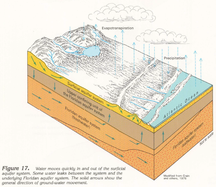
Conceptual model of the groundwater flow system, from Miller (1990).
The estimated predevelopment potentiometric surface is a composite of several maps developed over many years, the details of which are documented in Johnston and others (1980). This surface reflects the system in dynamic equilibrium where natural recharge is balanced by natural discharge and thus also reflects the natural circulation pattern of groundwater based only upon the effects of geology and terrain. Bush and Johnston (1988) estimated the predevelopment recharge and discharge for each basin using a numerical model, noting that their simulated values are less than independently estimated values owing to the large scale of their model grid and inability to simulate local flow systems. The most recent potentiometric map of the Florida aquifer system represents conditions in May-June 2010 (Kinnaman and Dixon, 2011) was modified to include equivalent freshwater head data in south Florida (Kuniansky and Dixon, written commun., August, 2014). Although groundwater development captures some of the water that would naturally discharge from the system and alters the potentiometric surface, boundaries of the major groundwater basins delineated from the estimated predevelopment map generally reflect conditions in 2010 as well.
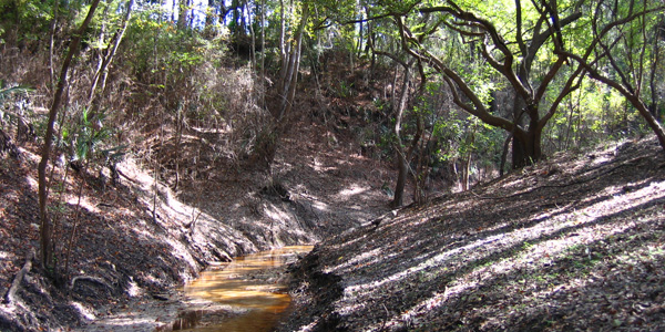
Recharge to and discharge from the FAS occur through a variety of pathways and the most dominant characteristic of the system controlling these processes is the degree of confinement (Bush and Johnston, 1988; Williams and Kuniansky, 2015; Williams and others, 2011). Unconfined and thinly confined areas are where direct recharge from precipitation enters the system and aggressive dissolution of carbonates occurs (Miller, 1999). Resulting karst features allow for rapid infiltration of water into the FAS during rainy periods and while there can be short periods of drawdown during drier months, groundwater hydrographs do not indicate regionally-extensive, long-term removal of groundwater from storage in these areas. In the more confined parts of the FAS, permanent removal of groundwater from storage has occurred, as indicated by long-term declines in groundwater levels, and rates of water level declines range from 0.40 to 0.67 ft/yr (Williams and others, 2011). Where the FAS is unconfined and water table conditions prevail, the FAS likely has a larger storage coefficient due to gravity drainage than in more confined areas, which may also contribute to observed differences in long-term hydrographs.
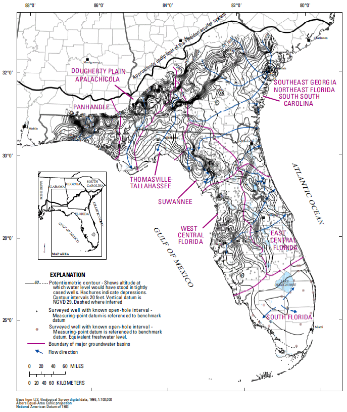
Groundwater basins and potentiometric surface map, MayJune, 2010 (modified from Kinnaman and Dixon [2011] by Kuniansky and Dixon, written commun., August, 2014). |
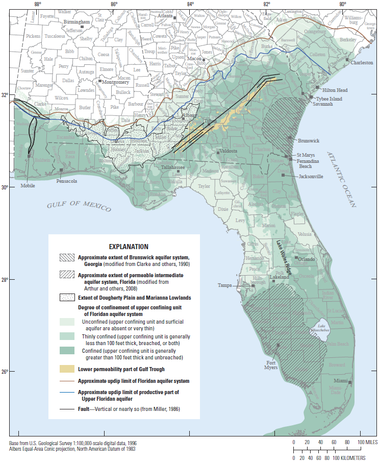
Relative degree of confinement of the upper confining unit of the Floridan aquifer system, from Williams and Kuniansky (2015). |