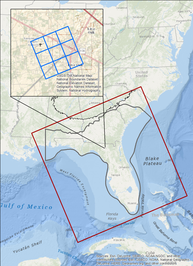
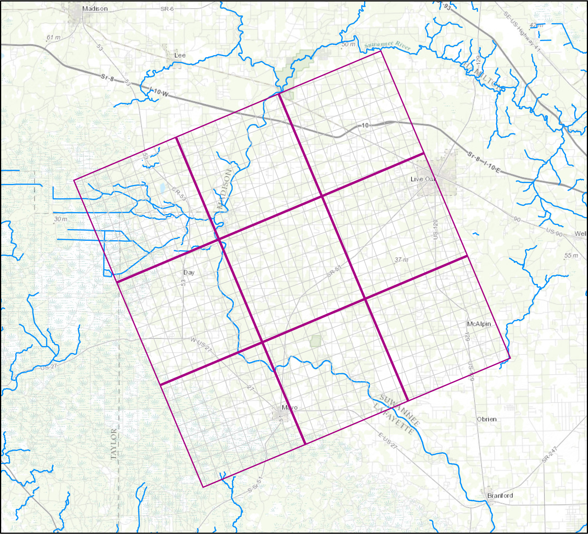
Extent of model grid with inset showing proposed 1 mile by 1 mile grid.
Understanding of the regional groundwater flow system of the Floridan aquifer system requires a large-scale numerical model encompassing the entire aquifer system that incorporates all of the boundary conditions, aquifer characteristics, and stresses which exert control on flow. Such a tool can be used, for example, to compute water budgets for the aquifer system, examine changes in storage, or to create water-level change maps.
A new regional model of the entire Floridan aquifer system – built and run with the latest data, codes, and hardware – will build upon our current understanding of the system. The regional model developed for the RASA Study in the 1980s (Bush and Johnston, 1988) was simplified due to computing constraints and is no longer a viable tool for assessing regional groundwater flow in the system.
The primary function of this new model is to represent, in as reasonable manner as possible, the regional distribution of heads and flow within the Floridan aquifer system under predevelopment, current, and future conditions.
The new model developed for this study will improve upon the existing RASA Model by:
- reducing the grid cell size from 8 by 8 miles to 1 by 1 mile,
- explicitly simulating flow within the surficial aquifer system, upper confining unit, and middle confining units,
- simulating aquifer system responses to transient stresses,
- projecting groundwater availability under a variety of projected climatic and pumping conditions, and
- simulating gross changes in the position of the freshwater/saltwater interface.
Model Grid
The new Floridan aquifer system model will use a traditional finite-difference grid with uniform spacing of model cells, 1 mile on a side. Alignment of the grid will roughly coincide with the longitudinal axis of the Florida peninsula and the previous RASA Model grid (above and left). Extent of the grid will encompass the entire Floridan aquifer system, except the small part that underlies Mississippi where the system is saline and not used.
Horizontal spacing of grid cells in the RASA Model is 8 miles on a side. Computational limitations of the time made this relatively coarse grid spacing necessary; however, resulting calculations of recharge and discharge to and from the system are considered to be less than the actual values because local recharge and discharge occurring completely within one model cell (64 square miles) cannot be simulated. By reducing the size of each grid cell to 1 square mile, the new Floridan aquifer system model will be able to produce better estimates of recharge and discharge.
Surficial Aquifer System and Confining Units
The RASA model represented the surficial aquifer system as a constant head source and the upper and middle confining units were simulated using a quasi three-dimensional approach in which leakage across these units was considered vertical and instantaneous. This instantaneous leakage of water across confining units and from unlimited reservoirs such as the constant-head surficial aquifer layer could potentially diminish the effects of pumping on system response in some areas. In the new model, flow will be explicitly simulated in the surficial aquifer system and intervening confining units adjacent to and within the Floridan aquifer system to better represent flow within and between aquifer systems.
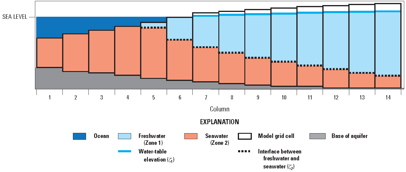
Freshwater/Saltwater Interface
Movement of the freshwater/saltwater interface will be simulated using the sharp-interface approach implemented in the Seawater Intrusion (SWI2) package for MODFLOW (Bakker and others, 2013). This approach assumes advection and dispersion are negligible and solves a set of differential equations equivalent to the groundwater flow equation for uniform-density flow. Density effects are incorporated into MODFLOW-2005 by adding pseudo-source terms to the groundwater flow equation. The approach is appropriate for regional scale problems and results in significant run-time savings, allowing such an analysis to be undertaken.